Home
Explore
Dashboard
Sign out
Signin
كيفية تسقيط صورة من Google Earth على برنامج AutoCAD بنفس الاحداثيات
Geomatics Online
•
April 6, 2021
You May Also Like
Geomatics Online
View Channel
About
No channel description available.
Latest Posts
convert autocad file to arcgis pro
Geomatics Online
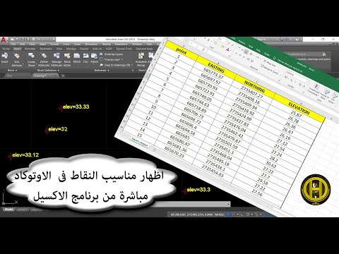
اظهار مناسيب النقاط في الاوتوكاد مباشرة من برنامج الاكسيل
Geomatics Online
كيفية تسقيط صورة من Google Earth على برنامج AutoCAD بنفس الاحداثيات
Geomatics Online
14# كيفية استخراج المناسيب من برنامج جوجل ايرث وتحويلها الى الاكسيل
Geomatics Online
Home
AiChat
Shop
Saved
Account
AI Assistant
Loading...
Show More
No messages yet. Start a conversation!